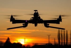
Robot drones enable real-time collection and analysis of operating conditions humans just can’t match in their timeframes.
We all know that robots are taking on starring roles in factories and other industrial settings — in fact, the sight of robotic arms applying parts on assembly lines has been a familiar one for decades. Now,a new twist — robotic drones are taking on the work of surveying sites from a high-level perspective, helping to quickly spot problems long before human operators are aware — while also meeting environmental regulatory requirements.
In a presentation and paper presented at the recent IEEE Edge Computing conference, a team of researchers led by Roberto Silva Filho of the General Electric Global Research Center (GE-GRC) demonstrated how robot drones have played a role in remote methane inspection in an oilfield, helping to catch serious problems before they become problems.
See also: What’s up with IoT and drones?
They describe a robotic platform, called Raven, developed within Baker Hughes and GE-GRC, which supports the interaction among semi-autonomous robots, human supervisors, model-based edge controls, and cloud services. Raven employs drones to help automate the field data collection and detection of methane leaks in oil and gas facilities, Filho and his team explain.
Tackling labor-intensive tasks
These drones automate “the otherwise labor-intensive task currently performed by human inspectors that need to manually inspect facilities and pipelines using optical gas imaging (OGI) devices. This method is time-intensive and the data provided by the measurement device is qualitative in nature. i.e. it only provides a binary (yes/no) indication of leakage with no measurement of its intensity. Additionally, the OGI devices are expensive and difficult for operators to deploy at-scale.”
The team outlines the six steps that deliver real-time drone data to operators:
- “The field engineer browses existing oil facilities, reviewing past inspection reports and decide which one to inspect. Based on the sitemap and layout, the engineer plans the flight route for the UAV to collect methane data and detect leaks.”
- “Upon arriving at the site, the engineer reviews the inspection plan and connects the mobile device with the drone. Typically, supporting servers are located in the engineer’s truck. Once the mobile device connects with the drone, the inspection plan will be uploaded to UAV’s navigation controller.”
- “The engineer checks the status of drone before launching it.”
- “The engineer uses the mobile device to monitor the inspection progress, the current methane readings, and the status of the UAV.”
- “The field engineer can review the summary of collected data in statistics and visualization, and put in additional remarks about this inspection.”
- “A report will be auto-generated and all the data will be uploaded to the Cloud Services for further processing and archiving.”
The geolocated heat map is produced from the drone, employing a laser-based methane sensor pairs methane concentration values with the GPS coordinates. “The operator at the ground-level is able to quickly identify where potential leaks may be,” the team explains. The platform also delivers a live video feed that points the inspector “to the exact location of the UAV, so the concentration hot spots are easily identifiable. In addition, Filho and his co-authors add, “during post-flight processing, the collected imagery is converted into a new/updated 2D image of the facility,” allowing for greater accuracy.
Joe McKendrick is RTInsights Industry Editor and industry analyst focusing on artificial intelligence, digital, cloud and Big Data topics. His work also appears in Forbes an Harvard Business Review. Over the last three years, he served as co-chair for the AI Summit in New York, as well as on the organizing committee for IEEE's International Conferences on Edge Computing. (full bio). Follow him on Twitter @joemckendrick.

 Best Practices for Deploying and Scaling Industrial AIArtificial Intelligence (AI) is transforming industrial operations, helping organizations optimize workflows, reduce downtime, and enhance productivity. Different industry verticals leverage AI in unique ways.Link to The Center for Adaptive Edge Intelligence
 The Center for Adaptive Edge IntelligenceAdaptive edge intelligence brings real-time decision-making to the point of data creation, whether from sensors, machines, or cameras.Link to The Value of Vehicle Electrification
 The Value of Vehicle ElectrificationElectric vehicles (EVs) present automakers with many design, engineering, and manufactu ring challenges.Link to Accelerating Manufacturing Digital Transformation with Industrial Connectivity and IoT
 Accelerating Manufacturing Digital Transformation with Industrial Connectivity and IoTDigital transformation is empowering industrial organizations to deliver sustainable innovation, disruption-proof products and services, and continuous operational improvement.Link to Smart Manufacturing for Automotive
 Smart Manufacturing for AutomotiveLeading a transportation revolution in autonomous, electric, shared mobility and connectivity with the next generation of design and development tools.Link to Center for Data Pipeline Automation
 Center for Data Pipeline AutomationAs businesses become data-driven and rely more heavily on analytics to operate, getting high-quality, trusted data to the right data user at the right time is essential.Link to Center for Automated Integration
 Center for Automated IntegrationThe goal of automated integration is to enable applications and systems that were built separately to easily share data and work together, resulting in new capabilities and efficiencies that cut costs, uncover insights, and much more.Link to Continuous Intelligence: Insights
 Continuous Intelligence: InsightsDigital transformation requires continuous intelligence (CI). Today’s digital businesses are leveraging this new category of software which includes real-time analytics and insights from a single, cloud-native platform across multiple use cases to speed decision-making, and drive world-class customer experiences.